Live Timing
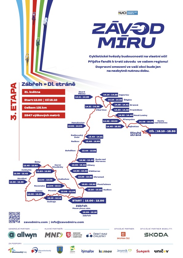
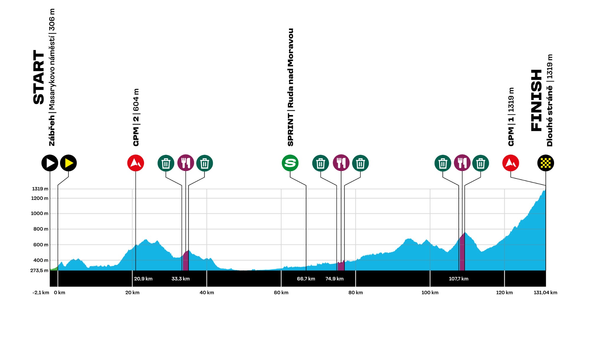
Open live timing| Place of the start: | Zábřeh, Masaryk square |
| Start: | 11:45 |
| Finish: | 14:55 - 15:15 |
| Stage length: | 131 km |
| Altitude meters: | 2,847 m |
Start:
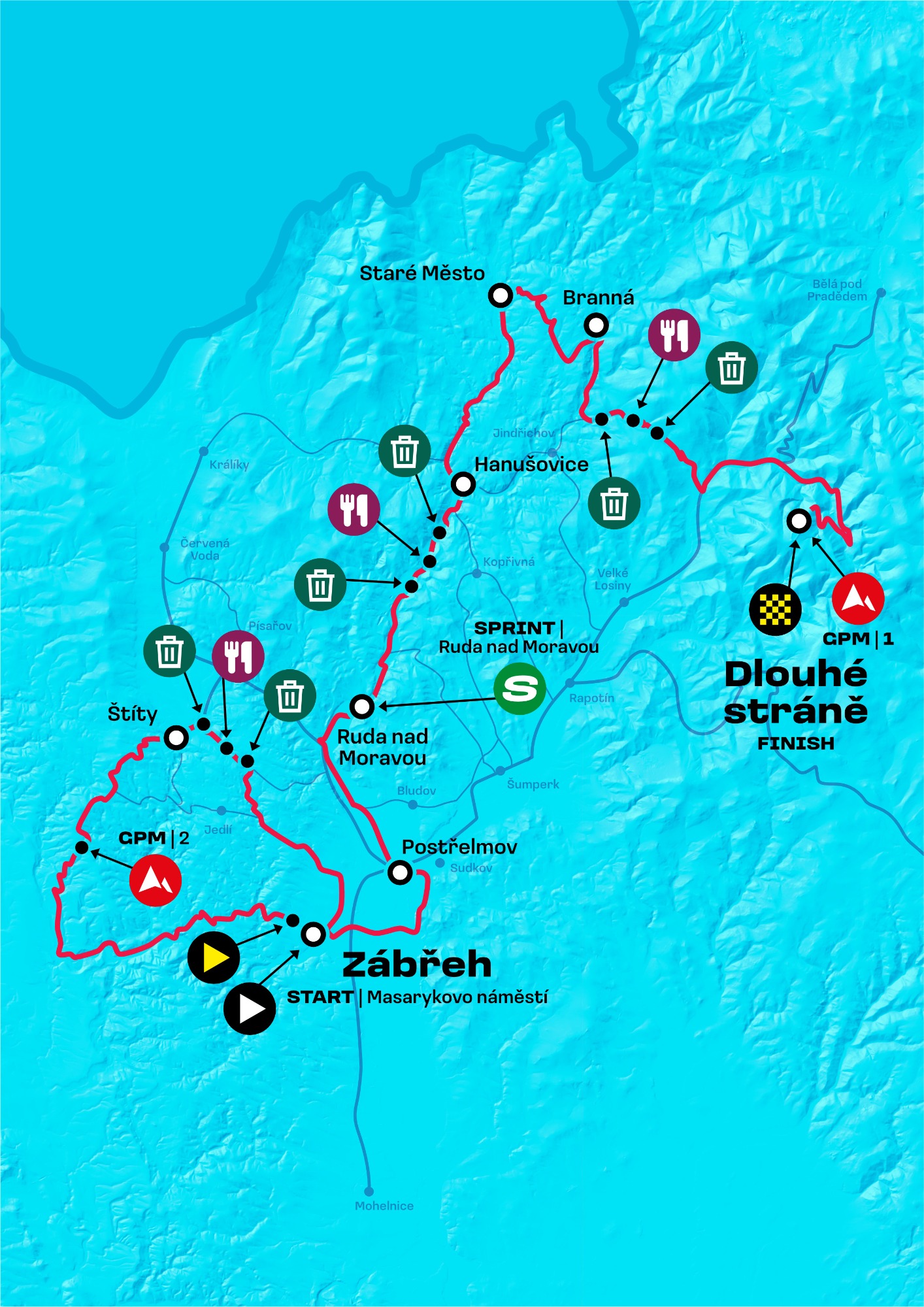
The Zábřeh settlement was established on the left bank of the Moravská Sázava River and its main function was to protect the ford across the river. The first mention of Zábřeh can be found in the charter of the Brno Provincial Assembly from 1254. The town was founded sometime in the second half of the 13th century by German-speaking colonists who probably came from the overpopulated German Saxony. In 1278 Zábřeh was already a town. The biggest cultural monuments are the local castle and the Churches of St. Bartholomew and St. Barbara.
Finish:
Dlouhé stráně is the highest mountain of the Desná Highlands with a height of 1354 m in the Hrubý Jeseník Mountains. The peak is located 4 km southeast of Kouty nad Desnou and 5.5 km west of its parent peak Praděd. On the peak there is a pumped storage power plant, which is a technical gem and the most powerful power plant of its kind in the Czech Republic.